As debate heats up over coal exports and oil shipments, Sightline is analyzing public at-grade rail crossings from Sandpoint, Idaho to Cherry Point, Washington.
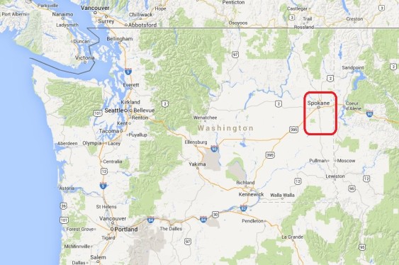
If fossil fuel companies succeed in shipping the volumes of fuel they have planned, they will—by sheer physical necessity—disrupt vehicle and rail traffic all along the rail route. In the first installment in this series we examined street closures in northern Idaho. In this chapter, we visit Spokane County, Washington.
Coal and oil trains—loaded in the interior of North American and bound for the coast—will close off rural roads and city streets alike for hours each day.
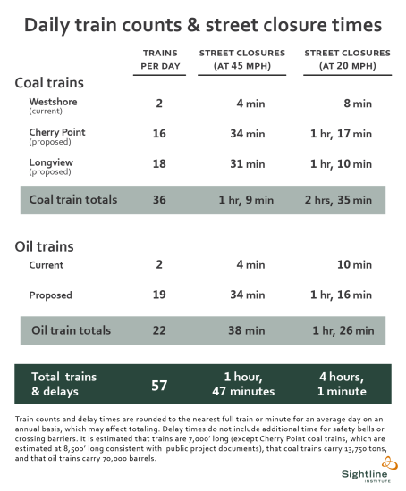
Importantly, the list of cities and crossings we analyze here is not comprehensive. Rather, we depict several representative locations in Spokane County. In each of these places, we estimate that new coal and oil trains would close streets by an average of between 1 hour and 47 minutes and 4 hours, each day, depending on train speeds.
Note that all images throughout this series can be clicked for enlargement.
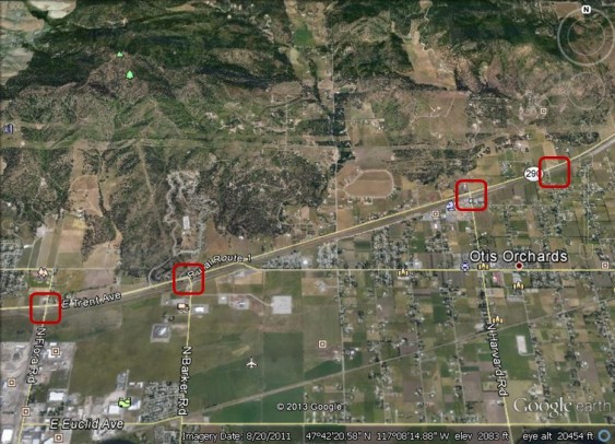
As trains cross the Idaho border into Washington’s Spokane County, they pass through the small town of Otis Orchards. Rail lines and roads intersect at four public grade crossings:
Otis Orchards, WA: McKenzie Road, Harvard Road, Barker Road, and Flora Road
About 50 trains pass through these crossings daily, meaning that coal and oil trains would roughly double existing freight rail volumes at the intersections. Each of these four crossings is protected by gates that are designed to lower when trains are approaching. The Barker Road crossing sees the most automobile traffic, with 1,250 vehicles on an average day. The Flora Road crossing is the nearest to a public school, Skyview Elementary, designated with a “children crossing” icon above the leftmost red rectangle above.
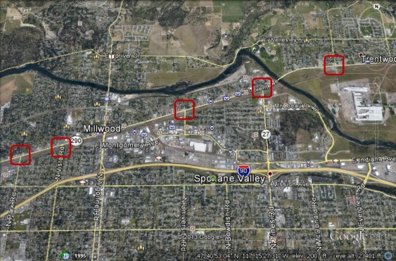
Proceeding west into the city of Spokane Valley, five more BNSF public grade crossings straddle the Spokane River:
Spokane Valley, WA: Evergreen Road, Pines Road, University Road, Vista Road, and Park Road
As in Otis Orchards, each crossing is protected by gates and each crossing sees 50 trains pass by daily. The busiest street is Pines Road (also called Route 27), where the crossing sees about 11,000 average daily vehicles. North of the Pines Road crossing, at a bend in the Spokane River, the green soccer player marks the Plantes Ferry Athletic Complex, which includes fields for softball and youth soccer teams. Church icons also depict multiple houses of worship in the immediate vicinity.
As coal and oil trains continue west, they next encounter street crossings in Washington’s second most populous city, Spokane:
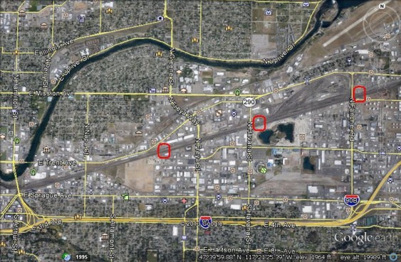
Spokane, WA: Airport Street, Alki Avenue, Fiske Street
There are multiple grade crossings within the city of Spokane, but because there are several arterial overpasses or underpasses that enable vehicles to avoid trains, street traffic at these crossings is very minimal. The image above shows three at-grade crossings: Airport Street, just to the east of a BNSF railyard, a crossing designated as “Alki Avenue” in official records, and Fiske Street. (Technical note: we identified anomalies related to many of the numerous at-grade rail crossings in Spokane, perhaps owing to data or reporting discrepancies between the Federal Railway Administration and the railroads.)
To the north of Fiske Street, just south of the Spokane River, the buildings and athletic fields of Spokane Community College are visible. To the west, on the north side of a bend in the River, are the buildings and athletic fields of Gonzaga University. To the east of Havana Street, a baseball icon represents the stadium of the Spokane Indians, a minor league team.
From Spokane, trains continue southwest on the BNSF mainline to encounter three at-grade crossings in the college town of Cheney:
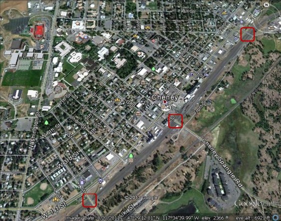
Cheney, WA: Pine Street, ‘H’ Street, and Cheney-Plaza Road
Cheney is home to Eastern Washington University. Its iconic football stadium, with a red field is visible in the northwest corner of the photo above; nearby are University buildings and other playing fields. BNSF public grade crossings include Pine Street, to the north; ‘H’ Street (actually located at F Street, downtown); and Cheney-Plaza Road (which turns into K Street at the south end of the City). Each crossing is protected by gates, and BNSF reports that 37 trains pass daily through each of these crossings.The busiest is F Street, which sees roughly 2,300 vehicles on a typical day.
From Cheney, coast-bound fossil fuel trains continue on into rural eastern Washington, soon encountering the little community of Tyler:
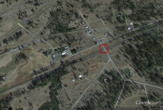
Tyler, WA: Pine Springs Road
There are four BNSF grade crossings in or near Tyler, including this one at Pine Springs Road (B Street). It is protected by gates, and currently sees 37 trains on an average day—a figure that would be dwarfed by the coal and oil trains planned for by projects in western Oregon and Washington.
Trains then continue southwest, crossing into Lincoln County, which we will analyze in the third installment in this series.
John Abbotts is a former Sightline research consultant who occasionally submits material that Sightline staff turn into blog posts.
Thanks to Devin Porter of Goodmeasures.biz for designing the table.
Click here for detailed notes on sources and methodology behind this series.
Have photos of a crossing featured in this series? Share them in our “Wrong Side of the Tracks” Flickr pool.


Comments are closed.