Editor’s note: This is Part 3 in a four-part series on how trees and plants help to slow traffic, ameliorate climate change impacts and make growing cities more livable. Read Part 1, which lays out the overall case for better street design, here. Read Part 2, which focuses on Vancouver and its green efforts in busier and denser areas, here.
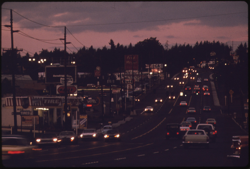
Time travel with me to 1973 Portland. The state legislature has just passed a landmark law establishing “urban growth boundaries,” launching the city toward its future of innovative planning. But if you look around, Portland’s streets are just like those of any American city—a highway builder’s dream.
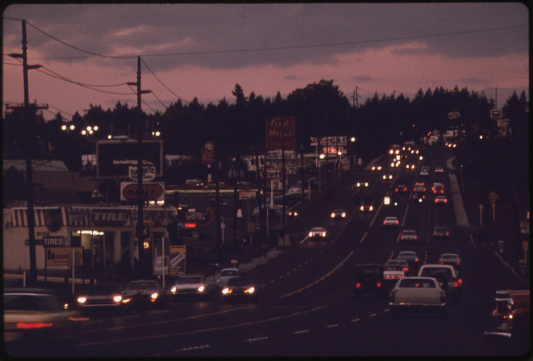
Most recent development is on the suburban model, designed almost as if to maximize use of the automobile. Streets like Southeast Division are the new normal:
Four to six lanes wide and lacerated with driveways leading to parking lots, often with no planted buffer between sidewalks and the cars racing past. Actually, in a lot of places … scratch the sidewalks. And unless you’re brave or a bit loony, forget about biking.
Fast forward to 2018. A stretch of Division from Southeast 11th Ave to Cesar Chavez Boulevard has transformed into something of a green oasis. Street trees shade sidewalks lined with planted swales where rainwater collects and filters through soil, sand, and gravel. At intersections, once-daunting multilane crossings are now pinched by vegetated extensions that also encourage people in cars to take the turns more slowly. In fact, drivers ease off the gas in general; who wants to rush through such a lovely corridor? And after all, there are all those people walking to the new apartments and street-level businesses.
Although it might be too early to call it the new normal for conditions on the ground, Division is one example of Portland’s redrawn paradigm for today and the future. In transforming such arterial streets, the city’s leaders and planners are weaving together over a decade’s experimentation with “green streets” that use nature to capture and clean roadway runoff and with creating “neighborhood greenways” that are calm enough for families to take to their bikes without fearing for their lives.
This transformative vision is gradually taking physical form in these streets, one construction project at a time. This decade’s growth surge replaces low-slung buildings and parking lots with multistory apartments and condos whose street-level shops and cafes face directly directly on the sidewalk.
A long gestation births a new model in the 2010s
Portland has had a version of a complete streets policy on the books since the 1970s, perhaps longer than any US city. Until this decade, that policy generally meant adding a sidewalk or painting a bike lane in conjunction with a scheduled paving project. But most of the arterial streets remained as dangerous and uninviting for people on foot or bicycle as they had always been, with multiple wide lanes that encourage speeding and make it dicey for all but the most fit to cross on foot. These arterials dominate what the city has designated its High Crash Network.
“Around 2010 the city began to look seriously at how to improve these streets to make them safer,” said Bob Stacey, a member of Portland’s Metro Council and longtime local activist on growth and transportation issues who lives a few blocks off Division. That focus has grown since the city adopted its Vision Zero safety initiative in 2015, following with an action plan in 2016 that emphasizes overhauling streets in the High Crash Network.

16-1529 by Dylan Passmore used under CC BY-NC 2.0
In developing schemes to refashion arterials from sewers for cars into meeting places for commerce, conviviality, and mobility, the city is drawing on techniques honed from its experience with green streets and greenways to make them leafier and lovelier as well as safer.
Portland got the jump on many other cities in aggressive use of green stormwater infrastructure to capture and filter road runoff when the city council adopted a “green streets” policy in 2007. Building from years of experimentation, the policy directed the transportation and environmental bureaus to work together to capture rainfall where it hits the ground rather than trapping it in gutters and piping it into area waterways. Instead, water collects in rain gardens, swales, tree wells and filters through permeable pavement.
“We had to work with transportation to fit these facilities in the right of way,” said Tim Kurtz, senior engineer at the Department of Environmental Services (DES). “Meanwhile, they had needs to address too, such as Safe Routes to School. They started using bulb-outs to slow traffic and we made that have a stormwater benefit.”
In 2009 the city retooled its program of creating what had been called “bicycle boulevards”—low-traffic neighborhood streets designated for cyclists—into “neighborhood greenways.” Greenways is something of a misnomer, because the focus is on providing a low-stress path for people biking or walking rather than replacing pavement with plants. But the techniques used to slow vehicles and discourage “cut through” traffic—curb extensions, diverters, traffic circles—mean that greenways provide more opportunities for literal greening with trees, swales and other vegetation. Portland today has a network of 90 miles of low-stress greenways, according to the Portland Bureau of Transportation (PBOT).
The green streets and greenways initiatives are showpiece successes, attracting tours of would-be emulators from near and far. But most of the green streets and greenways are on low-traffic side streets. Tackling the busy thoroughfares is a much taller order, notes Denver Igarta, PBOT’s supervising planner for complete streets. “Even today we have a third of our arterial streets lacking a sidewalk,” Igarta said. Car congestion is a growing challenge on the arterials. Reducing vehicle congestion in the long run will require making transit and biking more appealing options for Portlanders, and that can mean taking some space and time from cars. “We have intense competition for space in the right of way,” Igarta said.
Realizing a vision on Division
The city in 2014 completed its first major foray into transforming a car-dominated arterial into a calmer, greener boulevard on the 1.6 mile stretch of SE Division Street mentioned above. The transportation and environmental services departments collaborated to transform the streetscape along a 29-block corridor (you can see the block-by-block designs here), adding 124 streets trees to a mostly barren stretch, along with 55 vegetated swales, bus waiting areas and curb bulbs for safer crossings that serve as natural stormwater collectors.
“It’s much calmer,” said Jillian Detweiler, executive director of The Street Trust, a Portland-based group advocating for bicycling, walking and transit in Oregon. “The trees and vegetation are part of a design that sends a much different signal to drivers about what kind of a street it is, and what the purpose of the street is.” In fact, traffic is so slow that, with no bikeway on Division, impatient cyclists are more likely to use the greenway two blocks south, she said.
As the city works to bring these changes to other arterials, the transformation is continuing this year on a new stretch. In June, PBOT released updated plans for a somewhat less plant-intensive taming of “outer” SE Division Street, from 82nd to the city limit, a chief offender in the High Crash Network where five people were killed last year. The design adds a median of trees to help calm the street and make for safer crossings, as well as a new bikeway, three miles of sidewalks and new crossing signals. (More on the latest design here.)
Retrofits are coming to other arterials as well. Work started this spring on a redesign for a 40-block stretch of SE Foster Road. The current five car lanes will be reduced to three with a bike lane in each direction, and the skinny, five-foot sidewalks will expand to nine, shaded by 190 new street trees. As the city was looking to improve this arterial, the adjoining Mount Scott-Arleta and Foster-Powell neighborhood associations organized to advocate for the street trees and the lane reallocation to shorten crossing distances and reduce auto speeds. Though endorsed by the Foster Area Business Association and a unanimous City Council, some dissenting business owners have complained that the project will slow car travel too much while inviting gentrification.
Removing trees to improve safety?
Portland’s bid to green its busiest arterials faces a substantial obstacle: Many of them do double duty as city streets and state highways and are under the control of the Oregon Department of Transportation (ODOT). “It is a strongly held view of Portland’s traffic folks that street trees do have a calming effect,” helping to slow speeds and improve safety, said Stacey. But ODOT seems to have taken a different view recently in designing a safety-driven overhaul of SE Powell Boulevard, also known as US 26.
Portland’s bid to green its busiest arterials faces a substantial obstacle: Many of them do double duty as city streets and state highways and are under the control of ODOT.
The Inner Powell Safety Improvement Project, now under construction, will make $3.25 million worth of safety improvements on Powell between SE 20th and 34th avenues. They are meant to address what ODOT calls “high rates of rear end and turning crashes involving motorists, bicyclists and pedestrians.” Along with installing larger, more visible traffic signals and three flashing beacons to alert drivers when people are crossing the street, work crews actually are taking out trees. “They say that removing trees will improve visibility for drivers,” said Stacey, “so that when people step out to cross the street they will be seen by people driving 40 miles per hour.”
ODOT-owned streets such as Powell and 82nd Avenue have been dubbed “orphan highways,” urban streets beyond the control of the city whose safety issues for people on foot or bicycle the state has long neglected. Local elected officials are pressing state legislators either to require ODOT to redesign them or give them over to local control, with funding to fix them.

Cycling in Portland, carfreedays, Flickr. Cycling in Portland, carfreedays, Flickr.
The next frontier: Travel ways without cars
To expand the application of “green” beyond green streets and greenways, Portland is now preparing to create the Green Loop, a six-mile, park-like pathway carved from streets such as SE 6th Avenue and NW 8th Avenue for people on foot, bike or “mobility device” — but not cars. The Loop is included in a Central City 2035 Plan that city council approved June 6.
The Loop will be developed incrementally in coming years, adding street trees, swales and ribbons of lawn along streets that are primarily pavement today – assuming a funding plan comes together. Described by the city as “a transformative investment in our low-carbon ethos”, the Green Loop will be a substantial down-payment on livability in an area expected to absorb 30 percent of Portland’s population growth in the next 20 years. It is expected to be, as city literature says, “a catalyst to repurpose streets, reinvent our transportation connections and create new spaces for people.”
In a parallel effort to the Central City 2035 plan, PBOT this summer gathered input on Central City in Motion, a proposed network of low-stress biking streets, safer intersections for pedestrians and upgraded transit-ways designed to lure more people away from solo driving. Street trees and planted medians and curb extensions are present throughout the proposed cross sections. PBOT is now prioritizing projects for implementation.
Climbing back into our time machine, set the dial to 2035 and let’s take a look. Over the last 20 years, as an additional 250,000 people came to call themselves Portlanders, they found a growing selection of walkable neighborhoods with calm, green streets that invite a stroll or travel by bicycle, scooter and a growing array of options that don’t require a personally owned car. Longer and longer stretches of the city’s busiest, most dangerous streets — the car-only arterials of 1973 — have transmogrified into appealing public spaces that move ever more people. But one thing hasn’t changed: Other cities still look to Portland for inspiration on how to absorb more people while growing great streets for both people and nature.


