Jeff Mapes
As I researched my book Pedaling Revolution: How Cyclists are Changing American Cities, I couldn’t help myself. Everywhere I went, I critiqued the local streetscape by asking: is it good or bad for bikes?
When I visited my sister and brother-in-law on the Sammamish Plateau east of Seattle, I was quick to judge. We drove up a steep hill to get to their house, the main roads were narrow and filled with fast-moving cars, and the distances were long—too long for easy cycling. Except for the East Sammamish Trail along Lake Sammamish, there didn’t seem to be any infrastructure at all for cyclists or pedestrians.
In short, the fast-growing Sammamish Plateau seemed to share the crux transportation problem of sprawl everywhere: residents seemed locked in their cars for every trip.
My bike-riding brother-in-law John—a man who is hardened enough to have often commuted by bike to such far-flung workplaces as Redmond and downtown Seattle– proved my perceptions wrong.
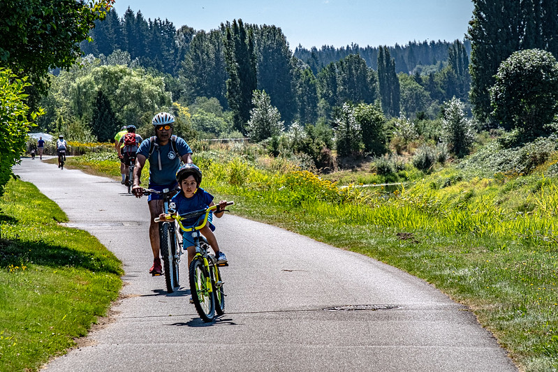
On a recent family visit, John suggested that we take a spin around the plateau by bike. With the thoroughness of a software engineer (which he is), John had over the years carefully scouted out a series of bike routes that largely avoid busy roads and provide pleasant riding. (Here’s a map that John made!)
We weren’t far into the 16-mile loop before I realized that I was seeing this cityscape from a whole new perspective. I realized that it was I, Mr. Pedaling Revolution, who had been guilty of seeing the world through an automotive windshield. (Maybe it was “car-head”?)
I was so accustomed to seeing the neighborhood from an automobile that I failed to see the cycling potential. Of course, I wasn’t alone in that blindness. During 90 sunshiny weekday minutes on the road, we didn’t see another cyclist. Not one.
It’s easy to guess why not. What I discovered on a ride was a lot of hidden bike infrastructure.
We threaded our way along several informal trails that walkers and other cyclists had cut through bits of unclaimed landscape—trails that linked one cul de sac-dominated subdivision to the next.


We biked between traffic-calming wooden barricades that neighbors had erected themselves—the outlaws!—to stop through-traffic.
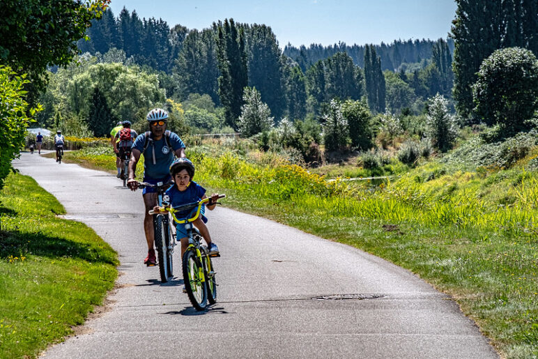
We also experienced some segments of official infrastructure: a paved bike and walking path next to a busy suburban thoroughfare, for example. . .


. . . and a short dirt-and-gravel bridal trail.
We biked 16 miles and spent only about one mile on busy roads. Our loop passed three schools and came near the plateau’s major shopping center.
Many residents of the plateau could bicycle in relative comfort to at least a few useful destinations. Getting to and from the plateau involves some steep hills that are a real deterrent to cycling, but once you’re there, the bicycle could be a viable transportation option for local trips.
My experience reinforced what I have learned during my conversations with planners and bikers from across Cascadia and beyond. While post-World War II sprawl was not built with bikes in mind, it can accommodate them better than you might expect.
A few strategic cut-throughs can slash distances for cyclists and walkers, giving them an alternative to inhospitable arterials. Multi-use paths can serve as highways for bikers and walkers, giving them a spine for their own network of no-motor routes.
Ironically, residents sometimes oppose such improvements; the trail along Lake Sammamish sparked legal battles from angry landowners. It’s much better to design these amenities into a subdivision before it is built; several studies suggest nearby trails can actually add to the value of a home.
In any case, I’m not predicting that the Sammamish Plateau will start to resemble the bike-friendliness of my hometown of Portland. Most people still have to travel too far for jobs, shopping and school to make cycling the most attractive option. And cycling to the store is clearly not much of a part of the local culture—yet. Few people move to the plateau in hopes of stepping away from the car-driving lifestyle.
But attitudes can change. We got a taste of that in 2008 when gasoline briefly cost $4 a gallon. If cycling becomes a cultural norm in the dispersed neighborhoods of the Sammamish Plateau—and in thousands of neighborhoods like them across Cascadia—residents may find they have more options than they realize. They just need to avoid my mistake, and stop judging the streetscape from the windshields of their cars.
Photos, map, and guide service all courtesy of John Gilbert. Thanks!
 Guest blogger Jeff Mapes is the author of Pedaling Revolution: How Cyclists are Changing American Cities. His day job is covering politics for the Oregonian.


carolyn
This is great! We do the same thing here in Anchorage. Although we have a wonderful in-town trail system, “official” trails are often separated by scary multi-lane thoroughfares that may or may not have a path or even a shoulder. Riders have circumvented this challenge by linking ad-hoc trails and cut-throughs that take one through patches of woods, parks, and quiet neighborhoods. Doing this can add to commuting time occasionally, but on the whole makes riding safer and more pleasant. Bravo!
VeloBusDriver
The beauty of the suburbs is that most neighborhood roads are lightly traveled, even during rush hour. When biking in South Bellevue I only encounter a few slow moving cars (kudos to Bellevue PD for ruthless enforcement of speed limits in our area). The roads have no shoulder or bike lane but passing is relatively easy since traffic is light. The arterial streets are a different matter. However, even in downtown Bellevue, there are places you can comfortably ride during rush hour. All it takes is careful route planning, riding predictably, and a touch of thick skin. Improved cycling facilities will help and Bellevue has many projects on the drawing board: http://www.ci.bellevue.wa.us/pedbikeplan.htmNow, if we can just figure out the funding issue…
Alan Durning
Carolyn—interesting! I wonder if Hidden Bikeways are the rule rather than the exception. Other readers? What’s your experience?Velobusdriver: slow-moving motorized traffic is such an important contributor to bike-friendliness. I would often prefer to ride on traffic-calmed city streets rather than a designated, off-street bike path. For one thing, designated bike routes are narrow. For another, walkers, joggers, rollerbladers, and toddlers can make off-street bike paths rather complicated environments for cycling. Segregated bikeways—those that are ONLY for biking, not walking, as found in northern Europe—are usually better than quiet car roads. But they’re most important parallel to busy roads. In Portland, bike boulevards are the main strategy to induce more cycling: bike boulevards are just regular residential streets that have been designated for cycling and updated with traffic calming street “furniture” such as curb bubbles, intersection circles, grid diverters, and the like. So Bellevue’s side streets may already be a good, starter bike infrastructure.
Maarten
Even better, the route shown on John’s map goes by two county parks with dirt trails that allow bicycling (or soon will): Soaring Eagle Park just north of Beaver Lake, and Duthie Hill Park off Duthie Hill Road, where a mountain bike park is under construction. So people and especially kids on the plateau have great bike recreation opportunities.(More info on mountain biking at those parks on the Evergreen Mountain Bike Alliance website, http://evergreenmtb.org/trails/ )
Corey Burger
The problem with most online maps is that simply don’t show bike trails. OpenCycleMap, which is based of OpenStreetMap data, is designed to change that. It mights bike-centric infrastructure like bike lanes and trails more prominent, over basic roads.
Lisa Albers
This is very useful information. I’m sending the link to this story to all my Sammamish friends.On a slightly related note, it would be helpful if Sound Transit didn’t penalize cyclists who catch buses from the Montlake Freeway Station to head over to the Eastside. Because we’re crossing Lake Washington on the 520, we are charged for 2 zones ($2.50) even though it’s a relatively quick bus ride, with no transfer, from there to Redmond.
VeloBusDriver
I’ve always disliked Metro and ST’s 2 zone fare for crossing the bridge. It is effectively a toll on cyclists in both time spent waiting for a bus as well as the fare itself.But here’s a bit of good news: Deadheading coaches can now take cyclists across the bridge for free. It’s part of a demonstration project to try and free up bike rack space on regular service coaches. For more info check out the “SR-520 Bicycle Demonstration Project” here: http://metro.kingcounty.gov/tops/bike/sr-520.html
Sebastian Helm
One thing I’ve been trying to lobby for are signs that announce to pedestrians and bicyclists that a dead end street is actually alive for them. There’s such signage in Germany. (I remember an ingenious combination of signs #240 and 357 here, but the standard would probably be sign 357, with something like 1022-10 underneath.)
Jeff Mapes
Thanks for the interesting comments everyone. Perhaps I need to write a sequel to my book based on the suburbs!Here’s my question for Carolyn: Could the City of Anchorage turn some of those informal trails into official routes? Or are the ownership issues too daunting?And I like Sebastian’s signage idea. Bike route signs are both useful and good advertising. In Portland, route-finding signs explicitly serve this dual function. They give riders directions, of course, but they also include the amount of time it takes to cycle to a certain destination, which is not as long as many people would guess.
Alan Durning
I’ve been intending to blog about Jeff’s book, but now I don’t need to. Read this great review from the NY Times (written by David Byrne of Talking Heads fame).http://www.nytimes.com/2009/05/31/books/review/Byrne-t.html